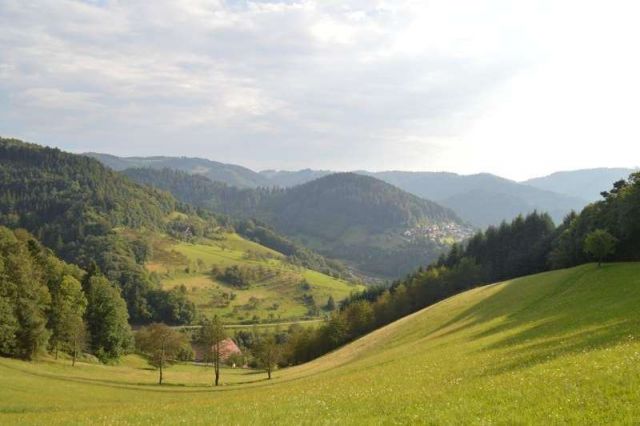
A Romanesque waterfall path, wonderful views and an alpine ridge crossing...that's our tour tip on the Karlsruher Grat via ferrata in the northern Black Forest near Ottenhöfen. The circular hike skilfully combines one of the most beautiful regions of the Black Forest with a touch of adventure (but only if desired).
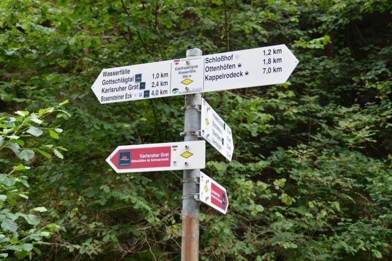
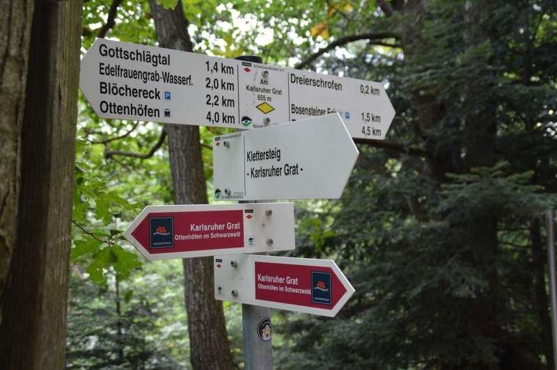
The starting point of our tour is the parking lot directly at the Ottenhöfen gravel works. Already at the beginning of the town, a large sign that cannot be overlooked points us in the direction of Karlsruher Grat / Waterfalls. Once there, we can find out about the following route of the via ferrata and the Gottschlägeal nature reserve on an information board.
The workers at the gravel works greet us in a friendly manner and seem to be used to meeting strangers here often. From the parking lot we follow the yellow diamond “Ottenhöfen im Schwarzwald”, which marks our circular hike.
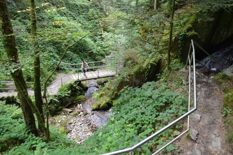
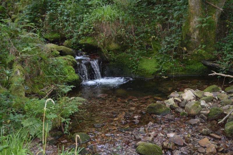
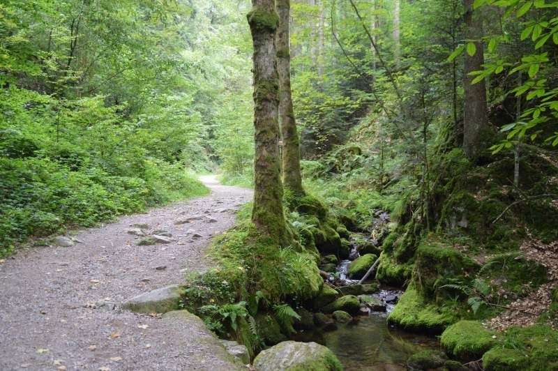
A gently flowing forest path that runs along the stream takes us directly to the entrance to the Edelfrauengrave waterfalls . A path secured by railings and stairs takes us spectacularly and well thought out through the adventurous waterfalls in about 20 minutes. We quickly gain height and after a short time find ourselves at the exit of the waterfalls.
From there the path leads us over a huge root labyrinth and continues slightly uphill directly onto a well-developed forest path. We follow the path until the forest clears and we reach the next signpost, continuing towards Karlsruher Grat.
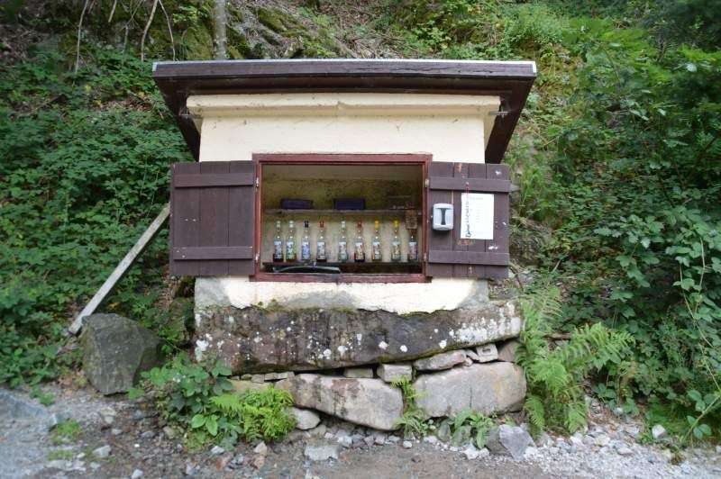
After a few minutes on a wide forest path, which is colorfully surrounded by Black Forest plants, we reach an optimally placed drinks fountain with a place to rest. When the temperatures are hot, this stone house filled with all kinds of chilled drinks is just right for us. All drinks, from non-alcoholic to schnapps and liqueur, leave nothing to be desired here.
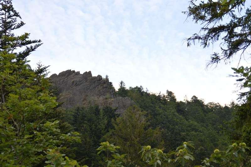
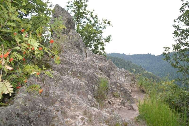
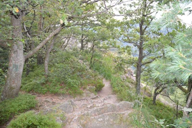
After a short refreshment, a narrow, moderately steep forest path takes us to the “Herrenschorfen” . On the way there we repeatedly overcome rocky slate slabs and we can imagine what an adventurous rocky ridge lies ahead of us. The “Herrenschorfen” can be climbed without any problems, although a certain degree of head for heights and sure-footedness are required here.
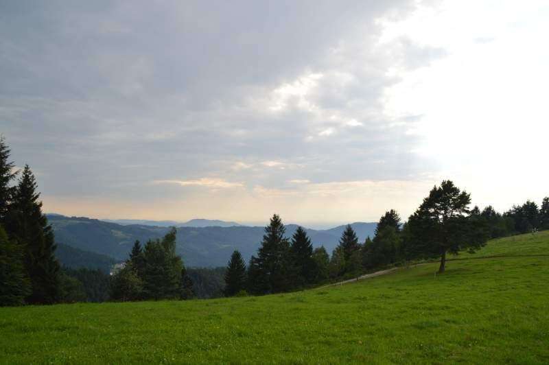
The view of the Gottschlägeal and back to the previous path is already magnificent and we take a few moments before we follow the path further uphill.
After a few meters we reach a smaller, open forest area where there is a signpost and another information board. Here we get detailed information about the geology of the Karlsruhe ridge.
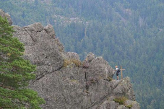
We follow the signs and reach the entrance via a soft forest path. From the first rock formation onwards, good sure-footedness is necessary. If you are undecided, follow the signposted bypass path, which runs directly below the ridge. The step, rocky and partly exposed ridge hike requires the use of hands again and again and requires simple scrambling, which makes crossing the ridge an unforgettable experience. The view becomes more beautiful with each step and we discover a wooden summit cross in the distance (attention! This can only be reached from below via unsecured climbing routes!).
The via ferrata takes us a few meters above the cross and we cross the ridge, now often on walking terrain again, in about 20 minutes. Gradually the rocks become smaller and a final look back over the entire ridge ends our little climbing session.
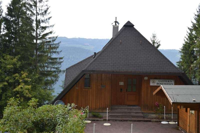
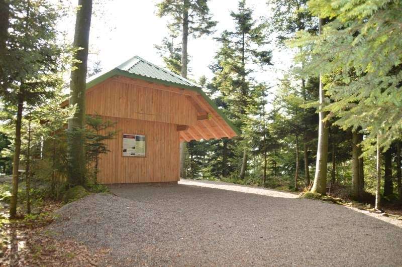
The path now leads directly to the bypass and after another 20 minutes (follow the ascending path!) we reach the “ Bosenstein ” rest house, where we can recharge our reserves a second time.
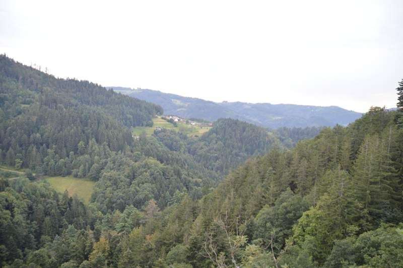
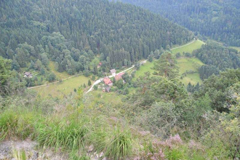
From here we hike on an asphalt path for about 500 meters until the path turns into a narrow meadow path that runs between forest and cow pastures. On the way there we have a great view of the Hornisgrinde, just a few kilometers away, the highest peak in the northern Black Forest at 1163m.
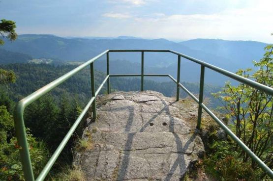
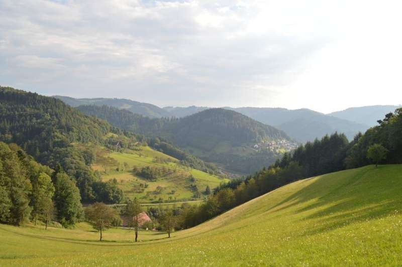
We follow the “Bosensteiner Almpfad” slightly descending through the forest until we reach the “brennte Schorfen” refuge. Behind this hut, a short path takes us through huge boulders to a small viewing platform , from which we have a wonderful view over Ottenhöfen, the Black Forest landscape, and into the Rhine valley. We follow our original path, the yellow diamond towards Ottenhöfen (from here approx. 3km).
From here, the route constantly alternates between forest paths, forest paths and asphalted, easily accessible mountain paths. Sometimes lonely, narrow trails lead us past fragrant wild berry bushes. The descending path is varied and as soon as we leave the forest, another wonderful view towards Ottenhöfen opens up before us.
A recently installed wooden bench above some Black Forest farms invites us to take another short break. The further route takes us in about 15 minutes to the Sternen restaurant in Ottenhöfen and in another 15 minutes to the starting point of our tour. The parking lot at the gravel works.


If you like the hike to the Karlsruher Grat, then you will definitely like our e-book. Lots of tips, ideas and suggestions for wonderful, authentic holidays with lots of nature and all the comforts in the Black Forest and more.
By submitting this form, you agree that we will send you advertising and information material about our services by email. You can object to the use of your email address free of charge at any time using the unsubscribe link contained in our emails or by sending a message to info@schwarzwald-ferienhaus.net. Further information can be found in our privacy policy .
Drinks fountain after approx. 1 hour
Gasthof Bosenstein after about 1:45 hours
Restaurant Sternen after about 3 hours at the end of the tour
If you want to spend a wonderful holiday in the northern Black Forest, then you should take a look at our specially equipped holiday properties near Karlsruher Grat and Ottenhöfen. Sauna, whirlpool, fireplace and more are waiting to be discovered by you!
Heiko Roth
Schillerstraße 62
72275 Alpirsbach
Telephone: +49 7444 4130
Email: anfrage@schwarzwald-ferienhaus.net